So I programmed those coordinates into my GPS receiver and headed out to the spot.
| I was
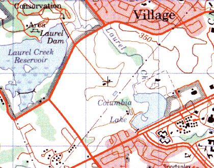
gazing at my topographical maps, when I noticed that on the north campus,
not far from the columbia lake townhouses, there WAS some buildings marked
on the map, where now there was none. And the map I was looking at
was not outrageously old, so I was pretty sure that that must have been the
farm that I'd photographed back in 1990. On the map at right, the crosshairs
in the middle of the picture is on the marked buildings. So I programmed those coordinates into my GPS receiver and headed out to the spot. |
|
|
Although
I didn't put much hope in it, I did try a google search to see if it would
turn up any clue. I searched for "University of Waterloo north campus
farm". Sifting through various links, I came across some PDFs of the
UW campus's master plan from 1992 at
http://www.uwaterloo.ca/documents/masterplan/
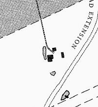
. In there I found a map of the north campus, as of 1992. This
map was a bit more detailed than the topographical map, and showed three instead
of two buildings at the site of the farm. This map also shows the planned
westmount road extension. Preparatory work for this was done in the
late 1980's. There are signs indicating "A regional road will be constructed
here", dated 1995. Fortunately, not much has happened since, at least
not at the site. I hope that road never happens. Note because
I care about that spot so much, but because I don't like more roads. The
only thing that keeps people from driving more and working further from their
homes is traffic congestion, so building more roads just leads to people
driving further. |
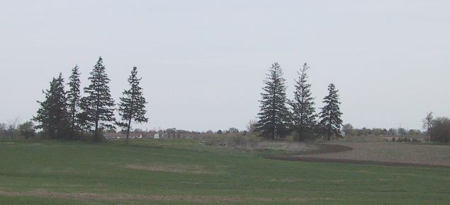
On the
black and white aerial photos, taken some time in 2000, you can see where
the farm house had once stood, but traces of the other two buildings
are pretty much nonexistent.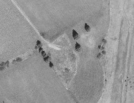
The driveway is still in use for driving tractors into the fields. |
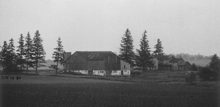
Looking
at the colour photographs, the farm was still there. Obviously, that photo
had been taken much earlier. By checking the state of various properties
around town in the colour photographs, I was able to determine that the date of
the colour photograph was some time in 1993.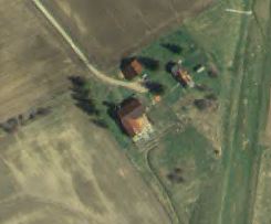
The green strip on the right is the prepared road bed for the westmount road extension. There's just grass growing in it at this point, which is why its so green on the photo. |
Update 2005
The mentioned road past the farm has unfortunately been built and opened in the fall of 2004. I'm sure its great progress in terms of releiving congestion elsewhere, but its sad to see more land turned into roads.
The spot is no longer suitable for a geocache, so the cache is no longer.
Go to My ruins page
![]()